

 An integrated “Seismotectonic Atlas of Greece”, which will provide the basis for a realistic assessment of earthquake hazard across the country, is being drafted by Greek geoscientists.
The group of scientists from the National and Kapodistrian University of Athens (EKPA) aim to capture the ground deformation across Greece.
 The geoscientists will correlate earthquakes, active rifts, and deformation of the Earth’s crust, thereby contributing to the assessment of seismic hazard and consequently earthquake danger.
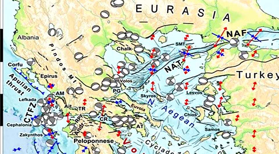
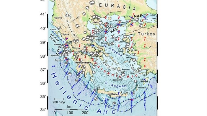
The first “Seismotectonic Map of Greece” was published by the Institute of Geological and Mining Research (IGME) in 1989, combining tectonic geology and seismicity on a scale of 1: 500,000.
As project coordinator John Kassaras, Assistant Professor at the EKPA Department of Geophysics and Geothermal Energy, told the Athens Macedonian News Agency, “the development of digital technology, satellite applications, the most sophisticated methodologies, a multitude of computing tools, and the availability of high volume and high-resolution EIAs instrumental observations will make the project easier and more accurate.”
“The new Atlas will be of practical use to geoscientists, civil engineers and government agencies responsible for infrastructure security and the management of earthquake disasters and crises,” Kassaras said.
See all the latest news from Greece and the world at Greekreporter.com. Contact our newsroom to report an update or send your story, photos and videos. Follow GR on Google News and subscribe here to our daily email!
